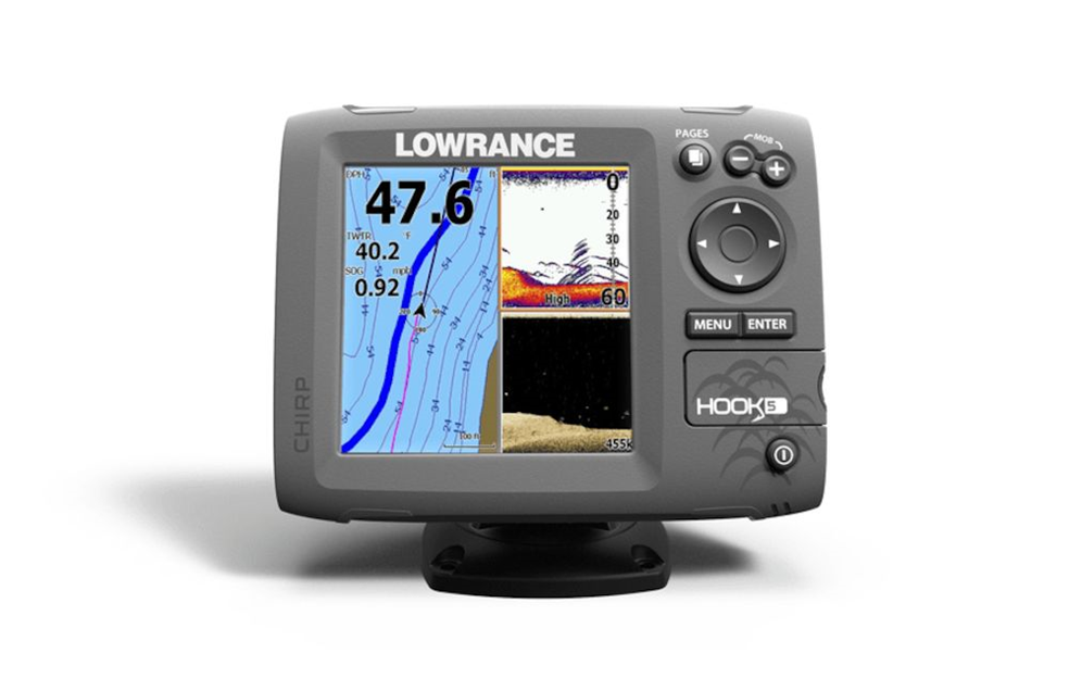
HOOK-5
SKU: 000-12655-001
000-12655-001Product details
The Lowrance® HOOK-5 fish finder/chartplotter combines excellent sonar features plus detailed chartplotting capabilities at an affordable price. CHIRP Sonar and optional DownScan ImagingTM technology give a clear and complete view of the underwater environment on a high-resolution, five-inch color display. Enhanced sonar sensitivity, excellent target separation and superior noise rejection make it easier to see fish targets, structure, cover, depth and bottom composition. The unit gives multiple CHIRP ranges from a single transducer and can display multiple CHIRP Sonar settings on one screen while the TrackBackTM feature allows anglers to review recorded sonar history. With a built-in GPS antenna and proven navigation features, revisiting favorite fishing spots is simple with the HOOK-5.
Key Features
- CHIRP sonar technology: Combine the power of two CHIRP ranges for the ultimate in target separation and noise rejection
- Hybrid Dual Imaging™ (HDI): The power of two award-winning technologies -- Broadband Sounder™ PLUS Exclusive DownScan Imaging™ -- combined to provide the best possible view of the water column and everything in it.
- DownScan Overlay™: Exclusive technology overlays DownScan Imaging onto Broadband Sounder display for one stunning view that separates and clearly exposes fish targets from surrounding structure. Overlay transparency and color palettes are fully adjustable.
- TrackBack™: Easily scroll back in sonar history to review covered areas and pinpoint spots (saves time and fuel trying to re-trace your path). With chartplotter models, simply mark a waypoint at your cursor location with the press of a button.
- Advanced Signal Processing™: Reduces manual adjustments to automatically see fish, structure and bottom detail more clearly.
- Reliable Navigation That’s Easy To Use
- Highly accurate, built-in GPS antenna plus a detailed U.S. map with more than 3,000 lakes and rivers, as well as coastal contours to 1,000 ft. A micro SD card can also be used to display Lake Insight™ and Nautic Insight™ HD and PRO cartography, as well as Navionics® Gold, HotMaps® Premium, Fishing Hotspots® PRO and Jeppesen C-Map Max-N Wide charts.
- Create your own map from real sonar data that you record with the online Insight Genesis™ map creation service
- Allows users to make their own custom, high-resolution contour, bottom hardness and vegetation maps from recorded sonar logs.
- HOOK-5 Color Display: Lowrance-exclusive, high-resolution, 5-inch, color display provides brilliant visibility and viewing detail in all conditions.
- All-New Page Selector: An easier-to-use menu system with quick access to all features using one-thumb operation.
- Multi-Window Displays: Choose from as many as eight preset page layouts, including up to three panels in split-screen mode to view chart, Broadband Sounder™ and DownScan Imaging™ -- all on one screen simultaneously. Multi-Window view can be accessed while viewing live sonar and charting.
- Supported by Lowrance Advantage Service program and limited one-year warranty.

Advanced Signal Processing

DownScan Imaging
Related Items


-
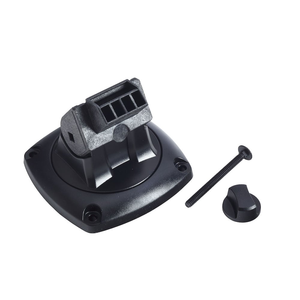
 Quick Release Bracket for Elite/Mark/Ti/GO/I3005 Models
-
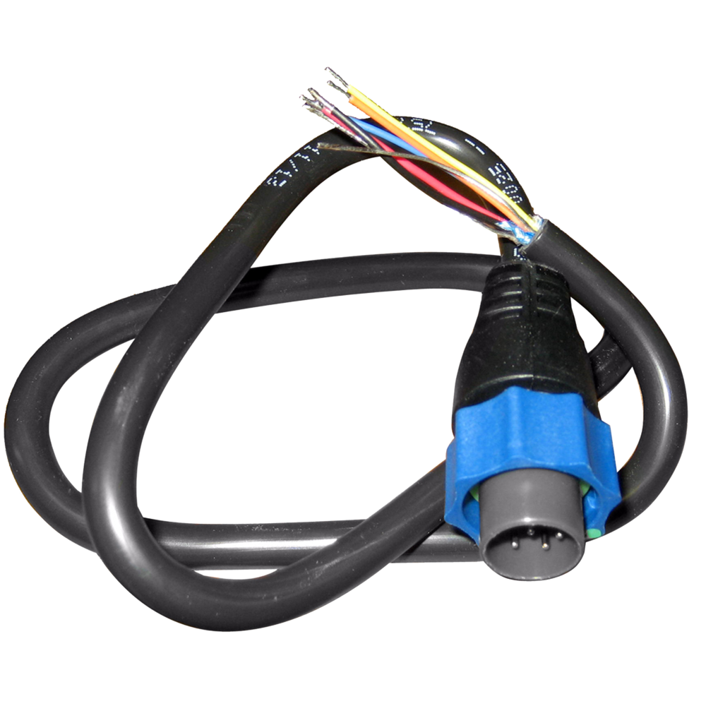
 HDS/Elite/Hook/Mark Power Only Cable
Specifications
- Display
- Backlight Color
- Pure White LED
- Display Resolution
- 480 x 480
- Screen Brightness
- 1500 nits
- Viewing Angles
- 80° top/bottom, 85° left/right
- Connectivity
- Bluetooth
- None
- Ethernet Ports
- None
- Connectivity Wi Fi
- None
- N2K PG Ns
- None
- NMEA 0183 Sentences supported
- TX / RX - GPS Receive GGA GLL GSA GSV VTG ZDA Transmit GGA GLL GSA GSV VTG ZDA GLC TX / RX - Navigation Receive RMC Transmit AAM APB BOD BWC BWR RMC RMB XTE XDR TX / RX - Sonar Receive DBT DPT MTW VLW VHM Transmit DBT DPT MTW VLW VHM TX / RX - Compass Receive HDG HDT HDM Transmit HDG TX / RX - Wind Receive MWV MWD Transmit MWV MWD TX / RX - AIS / DSC* Receive DSC DSE VDM *AIS sentences are not bridged to or from NMEA 2000.
- NMEA 2000 Connectivity
- None
- PC Connectivity
- None
- SD Card Storage
- Micro SD Card - 32gb max.
- Video
- None
- Cartography
- Charts supported
- Lake Insight™ and Nautic Insight™ PRO, Navionics HotMaps® Premium and Fishing Hotspots® PRO. Global chart upgrade options include Navionics + and Jeppesen C-MAP MAX-N
- Approvals
- Approvals Compliance
- FCC, Industry Canada, Radio Equipment Directive, ACMA, RSM
- Electrical
- Power Consumption max
- 1.0A
- Power Consumption min
- .05A
- Power Consumption typical
- .075A
- Recommended Fuse Rating
- 3A
- Supply Voltage
- 12v (10-17vDC)
- Environment
- Humidity
- 60°C, 95% relative humidity (RH) for 18 hours
- Operating Temperature Range
- 5°F to 131°F (-15°C to 55°C )
- Shock Vibration
- 100,000 cycles of 20 G
- Storage Temperature Range
- -40°F to 185°F (-40°C to 85°C )
- Waterproofrating
- IPX7 with card door closed
- GPS
- Correction
- DGPS, WAAS
- GPS Receiver Channels
- 16
- Position Accuracy
- 20m RMS
- Time to First Fix
- 30s
- Update rate
- 1 Hz
- MFD
- AIS
- AIS Chart overlay. Target vessel details.
- Autopilot
- None
- Cartography included
- World reference basemap and enhanced U.S. basemap with over 3,000 enhanced lake maps with depth contour and shoreline detail, plus coastal depth contours/shoreline detail and spot depth soundings to 1,000 ft./305 m
- Digital Switching
- None
- GPS
- Internal high-sensitivity WAAS + EGNOS + MSAS
- Internal Storage
- None
- Multimedia
- None
- Sonar Compatibility
- Integrated: CHIRP, Broadband & DownScan
- Waypoints, Routes, Tracks
- 3000 Waypoints, 100 Routes and 100 Trails with up to 10,000 points per trail
- Weather
- None
- Physical
- Compass Safe
- 12" (300mm)
- Mounting Type
- Gimbal Bracket or Dash Flush Mount
- Weight
- 1.60 lbs (0.70 kg)
- Radar
- Output power
- 500 watts
- Other
- Interface
- Keypad: 8-way directional keypad Zoom +/- Enter Menu Pages Light/Power MOB
- Languages
- Standard Language Pack: English, UK English, French, German, Italian, Spanish, Danish, Finnish, Greek, Norwegian, Portuguese, Sweedish, Afrikaans Eastern European Language Pack: English, UK English, French, German, Italian, Spanish, Bulgarian, Estonian, Croatian, Hungarian, Lithuanian, Latvian, Polish, Slovakian, Turkish, Czech, Romanian Russian/Ukranian Language Pack: English, UK English, French, German, Italian, Spanish, Russian, Ukranian Asian Language Pack: English, UK English, Japanese, Korean, Thai, Chinese-Simple, Chinese-Traditional, Vietnamese Middle Eastern Language Pack: English, UK English, French, German, Italian, Spanish, Arabic, Farsi
- Warranty Period
- 5 Years Total 1 Year Full Warranty Replace 4 Years InService Upgrade


