Skip to content

Elite-9 Ti² US Inland, Med/High + Active Imaging

SKU: 000-14652-001

A mid-sized display with a 9-inch, high-resolution SolarMAX™ touchscreen, the Elite-9 Ti² fishfinder/chartplotter supports Active Imaging™, FishReveal™, plus built-in high-detail US Inland charts and Genesis Live onscreen mapping.
x

The available screen sizes for the Elite Ti² range

x

Choose a map for your Elite Ti²

x

Choose a transducer for your Elite Ti²

$799

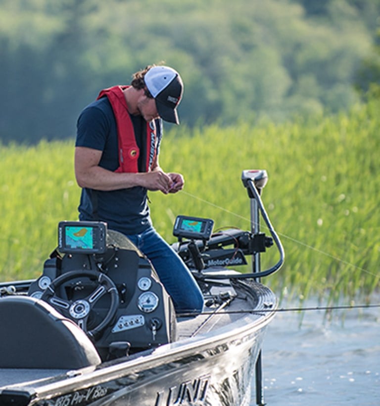
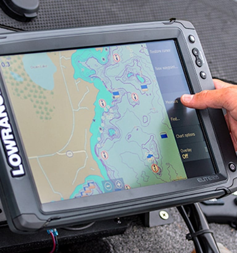
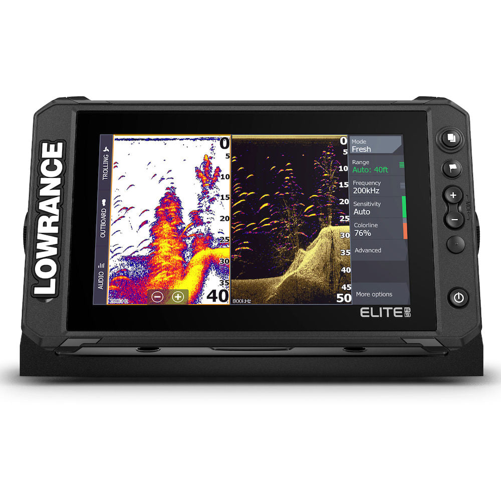
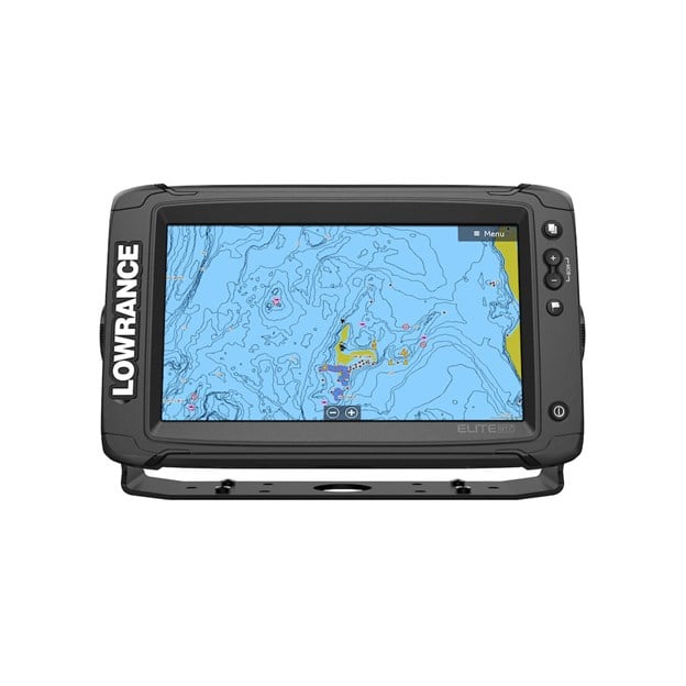
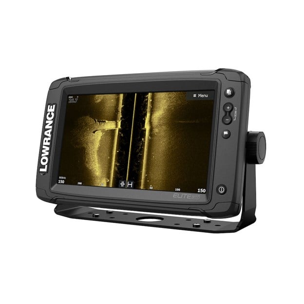
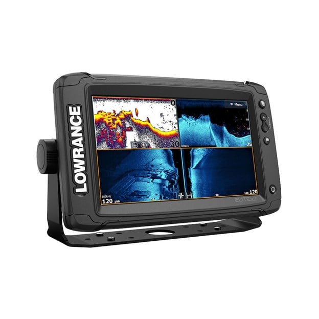
Professional Level Technology For All Anglers

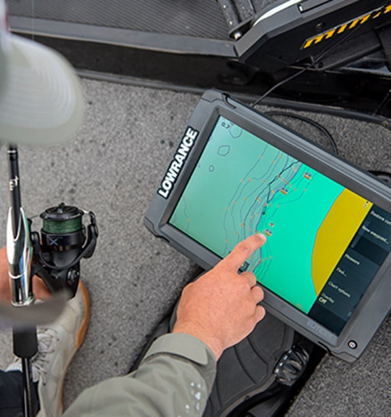
Elite Ti² packs Active Imaging™, our highest quality sonar ever, FishReveal™, built-in Genesis Live real-time mapping and enhanced screen clarity and target separation. Plus, with features that make your life easier on the water, like an easy-to-use touchscreen, wireless networking, smartphone notifications and trolling motor/Power Pole® integration – Elite Ti² was designed to help you have an easier time finding fish.

NEW Active Imaging

Perfect for pinpointing fish-holding areas like rockpiles, standing timber, weedbeds, ditches and drop-offs, NEW Active Imaging™ sonar delivers the most superior clarity and the highest resolution images of fish and structure at a longer range than any other structure-imaging technology.

Transducers sold separately.

Wireless Networking

For the first time ever with the Elite series, you won’t need any cables to share sonar, waypoint and route data between Elite Ti² displays with the new wireless networking capability.

eliteti2_block5_FW.jpg

Mapping In Real-Time

Update the maps of your favorite fishing spot or map unmapped areas with ½ foot contours – in real time – on the screen of your fish finder/chartplotter with C-MAP Genesis Live. Genesis Live uses digital depth to create high-definition maps featuring 1/2-foot contours. This level of detail makes it easy to find areas where fish like to hide, like drop-offs, points, and ditches. A truly customizable mapping experience, Genesis Live gives you control over contour transparency, contour density, depth and safety shading color palettes, and more. Create your Genesis Live maps in real-time, saving them as you go to a microSD card.

eliteti2_block7_FW.jpg

C-MAP® Easy Routing and Navionics® Dock-to-Dock Autorouting

Navigate faster and easier with automatic route planning. This menu-activated feature automatically plots the shortest and safest course based on a boat’s draft, beam and height, creating a route around a landmass, shoals and other fixed navigational hazards. Requires* C-MAP MAX-N+ charts, Navionics+ or Navionics Platinum charts.

*Subscription may be required.

eliteti2_block9_FW.jpg

Smartphone Notifications

Keep your eyes on the fish and never miss an important text or call with smartphone notifications built into Elite Ti². Turn off phone notifications for uninterrupted fishing, or leave them on to receive popup notifications on the screen of your Elite Ti² display.

hds-live-06-smartphone-notifications.jpg

Wireless Connectivity

With integrated wireless connectivity, you are able to download software updates and C-MAP Genesis maps directly to your display, and upload detailed service reports to technical support.

eliteti2_block13-FW.jpg

Enhanced Color Palettes

Customize the look and feel of your display with the enhanced color and contrast of Elite Ti² color palettes, making it even easier to distinguish fish from structure, the bottom and each other.

9_enhanced_color_pallets.jpg

Easy-To-Use Touchscreen

The touchscreen makes Elite Ti² displays easy to use, giving you fast, fingertip access to all Elite Ti² features and functions.

eliteti2_block17_FW.jpg

Enhanced Display Technology

The high-resolution SolarMAX™ display gives you a better view of fish and structure with new, enhanced screen clarity and target separation, even in bright sunlight.

eliteti2_block19_FW.jpg

Key Features

  • Active Imaging™ 3-in-1 (CHIRP/SideScan/DownScan) ready*
  • C-MAP® Genesis Live
  • Smartphone Notifications
  • Wireless Networking
  • FishReveal™ Smart Target View
  • C-MAP® Easy Routing, Navionics® Autorouting capability**
  • Preloaded C-MAP US Inland mapping with 1-foot contours on 4,000 lakes, plus a multitude of mapping options, including C-MAP, Navionics® and more)
  • Easy-to-use, high-resolution SolarMAX™ touchscreen display
  • Built-in CHIRP and Broadband Sounder®
  • Touchscreen control of Power-Pole® anchors, MotorGuide® Xi5 Trolling Motor***
  • Integrated wireless connectivity
  • SonicHub®2 compatible
  • NMEA 2000® engine support
  • Enhanced Surface Clarity lets you see more fish targets near the surface
  • Quick Access Control Bar provides one–touch access to system controls
* Transducer sold separately. ** Subscription may be required. *** Requires MotorGuide PinPoint Gateway.

What's in the box?

  • ACTIVE IMAGING XDCR Y-CABLE KIT
  • Elite-9 Ti² US Inland, No Transducer
  • LABEL,ELITE-9 TI2 M/H/LSS HD WF

Specifications

Display
Backlight Color
Pure White LED
Display Resolution
800x480
Screen Brightness
1200 nits
Viewing Angles
80° top/bottom, 85° left/right
Connectivity
Bluetooth
Integrated
Ethernet Ports
1 virtual ethernet port
Connectivity Wi Fi
Internal 802.11b/g/n
N2K PG Ns
Receive only65240 ISO Commanded Address, 127245 Rudder, 127251 Rate of Turn, 127257 Attitude, 127488 Engine Parameters, Rapid Update, 127489 Engine Parameters, Dynamic, 127493 Transmission Parameters, Dynamic, 127505 Fluid Level, 127508 Battery Status, 129033 Time and Date, 129038 AIS Class A Position Report, 129039 AIS Class B Position Report, 129040 AIS Class B Extended Position Report, 129794 AIS Class A Static and Voyage Related Data, 129801 AIS Address Safety Related Message, 129802 AIS Safety Related Broadcast Message, 129808 DSC Call Information, 130313 Humidity, 130314 Actual Pressure, 130576 Small Craft Status, 65285 Temperature with Instance, 65325 Reprogramming Status, 65480 Parameter Reply, 130817 Product Information, 130820 Reprogramming Status, 130832 Fuel Used – High Resolution, 130834 Engine and Tank Configuration, 130838 Fluid Level Warning, 130842 AIS and VHF Message Transport, 130843 Sonar Status – Frequency and DSP VoltageTransmit and Receive:59392 ISO Acknowledgement, 59904 ISO Request, 60160 ISO Transport Protocol, Data Transfer, 60416 ISO Transport Protocol, Connection Management, 60928 ISO Address Claim, 126208 NMEA Group Function, 126464 Receive/Transmit PGN’s group function, 126992 System Time, 126996 Product Information, 127237 Heading/Track Control, 127250 Vessel Heading, 127258 Magnetic Variation, 128259 Speed, 128267 Water Depth, 128275 Distance Log, 129025 Position, Rapid Update, 120296 COG and SOG, Rapid Update, 129029 GNSS Position Data, 129283 Cross Track Error, 129284 Navigation Data, 129539 GNSS DOPs, 129540 GNSS Sats In View, 130074 Route and WP Service – WP List - WP Name and Position, 130310 Environmental Parameters, 130311 Environmental Parameters, 130312 Temperature, 130577 Direction Data, 61184 Parameter Command, 65292 Clear Fluid Level Warnings, 65293 LGC-2000 Configuration, 65323 Data User Group Request, 130831 EP-20 Suzuki Engine and EP-50 Storage Device Configuration, 130835 Set Engine and Tank Configuration, 130839 EP-45 Pressure Configuration, 130840 Data User Group Configuration, 130845 Parameter Handle, 130850 Event Command, 130851 Event ReplyTransmit only65287 Temperature Sensor Configuration, 65289 Trim Tab Configuration, 65290 Paddle Wheel Speed Configuration, 130818 Reprogramming Data, 130819 Request Reprogram, 130828 Set Serial Number, 130836 Fluid Level Configuration, 130837 Fuel Flow Turbine Configuration
NMEA 0183 Sentences supported
TX / RX - GPSReceive GGA GLL GSA GSV VTG ZDATransmit GGA GLL GSA GSV VTG ZDA GLCTX / RX - NavigationReceive RMCTransmit AAM APB BOD BWC BWR RMC RMB XTE XDRTX / RX - SonarReceive DBT DPT MTW VLW VHMTransmit DBT DPT MTW VLW VHMTX / RX - CompassReceive HDG HDT HDMTransmit HDGTX / RX - WindReceive MWV MWDTransmit MWV MWDTX / RX - AIS / DSC*Receive DSC DSE VDM*AIS sentences are not bridged to or from NMEA 2000.
NMEA 2000 Connectivity
1x Micro-C
PC Connectivity
None
SD Card Storage
1 micro SD card up to 32GB
Video
None
Cartography
Charts supported
C-MAP (MAX N, MAX N+)C-MAP GenesisC-MAP Precision Contour HD (AMER ONLY)Navionics (Gold, NAV+ Platinum+)Insight (Pro and HD)Lowrance Regional Mapping Partners
Electrical
Power Consumption max
0.9A @ 13VDC with backlight on full
Power Consumption min
0.9A @ 13VDC with backlight on full
Power Consumption typical
0.9A @ 13VDC with backlight on full
Recommended Fuse Rating
3A
Supply Voltage
12v DC (10.8-17VDC)
Environment
Humidity
60°C, 95% relative humidity (RH) for 18 hours
Operating Temperature Range
5°F to 131°F (-15°C to 55°C )
Shock Vibration
100,000 cycles of 20 G
Storage Temperature Range
4°F to 140°F (-20°C to 60°C )
Waterproofrating
IPX7 with card door closed
GPS
Correction
DGPS, WAAS
GPS Receiver Channels
16
Position Accuracy
20m RMS
Time to First Fix
30s
Update rate
10 Hz
MFD
AIS
AIS Chart overlay. Target vessel details.
Autopilot
MotorGuide Xi5/Xi3 Trolling Motor *requires Motorguide PinPoint Gateway
Cartography included
C-MAP US Inland Basemap (US Inland models)Navionics basemap (AMER, AUS/NZ and US Costal/ROW models)
Digital Switching
None
GPS
10 Hz Internal high-sensitivity WAAS + EGNOS + MSAS
Internal Storage
None
Multimedia
None
Sonar Compatibility
Integrated: CHIRPBroadbandActive Imaging DownScanActive Imaging SideScanCompatible with:StructureScan
Waypoints, Routes, Tracks
3000 Waypoints100 Routes100 Trails with up to 10,000 points per trail
Weather
None
Physical
Compass Safe
12" (300mm)
Mounting Type
Gimbal Bracket or Dash Flush Mount
Weight
2.20 lbs (1.00 kg)
Other
Interface
TouchscreenZoom +/-MOB = (+/- combined)PagesWaypointLight/Power
Languages
Language on products will vary depending on where you purchase the unit. However, all units since 2017 come with basic languages including English, French, German, Spanish, Finnish, Italian, Dutch, Norwegian, Portuguese, Swedish & Chinese. Additional language packs are also available, for these please contact your local distributors, retailers or dealer, where you purchased your unit from. Standard Language Pack: Afrikaans/Afrikaans, Danish/Dansk, German/Deutsch, English (US), English (UK), Spanish/Español, Finnish/Suomi, French/Français, Greek/Ελληνικά, Icelandic/íslenska, Italian/Italiano, Dutch/Nederlands, Norwegian/Norsk, Portugese (Brazil)/Português (BR), Portugese (Portugal)/Português (PT), Swedish/Svenska Asian Language Pack: English (US), English (UK), Japanese/日本語, Korean/한국어, Thai/ภาษาไทย, Chinese - (simplified) China/简体中文, Chinese - (traditional) Taiwan/繁體中文 Eastern European Language Pack: Bulgarian/Български, German/Deutsch, Estonian/Eesti, English (US), English (UK), Spanish/Español, French/Français, Hebrew/ عبری , Croatian/ Hrvatski, Hungarian/ Magyar, Italian/Italiano, Lithuanian/Lietuvos, Latvian/ Latvijas, Polish/Polski, Slovak/ Slovensky, Turkish/Türkçe Russia/Ukraine Language pack: German/Deutsch, English (US), English (UK), Spanish/Español, Italian/Italiano, Russian/Русский, Ukraine/ Українська Middle Eastern Language Pack: Arabic (UAE)/ العربية , German/Deutsch, English (US), English (UK), Farsi/ فارسی , French/Français, Italian/Italiano
Warranty Period
2 years + 3 additional years of upgrade options. Totaling 5 years

Software Updates & Manuals

Need help with your product?

The Lowrance Help & Support area contains articles and videos to help you get the most from your product.

Help & Support