REVEAL™ charts bring you the very best of C-MAP®, including game-changing Shaded Relief – bringing the world around and beneath you to life in a completely new way – now available everywhere.
CORE FEATURES
Every REVEAL™ chart includes:
- FULL FEATURED VECTOR CHARTS
- TIDES & CURRENTS
- HI-RES BATHYMETRY LAYER
- DETAILED MARINA PORT PLANS
- INTEGRATED GENESIS LAYER
- CUSTOM DEPTH SHADING
- 12 MONTHS’ FREE UPDATES
- SUBSCRIPTION-FREE EASY ROUTING
- AERIAL PHOTOGRAPHY
- SATELLITE OVERLAY
- SHADED RELIEF
- DYNAMIC RASTER CHARTS
REVEAL™ LAKES
The ultimate chart for inland, with all the features of DISCOVER™, and more. Shaded Relief will let you see the river or lakebed beneath you like never before. Includes exclusive C-MAP® Survey data.
Packed with features anglers will love – clearly identify structure, reefs and ledges to find the very best fishing and diving spots. With 12 months’ free updates.
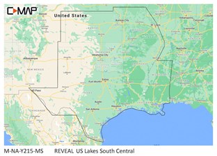
C-MAP® REVEAL™ - US Lakes South Central
The premium mapping solution for cruisers, anglers and sailors looking for accurate, quality data with game-changing shaded relief from the market-leader.
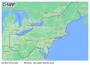
C-MAP® REVEAL™ - US Lakes North East
The premium mapping solution for cruisers, anglers and sailors looking for accurate, quality data with game-changing shaded relief from the market-leader.
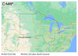
C-MAP® REVEAL™ - US Lakes North Central
The premium mapping solution for cruisers, anglers and sailors looking for accurate, quality data with game-changing shaded relief from the market-leader.
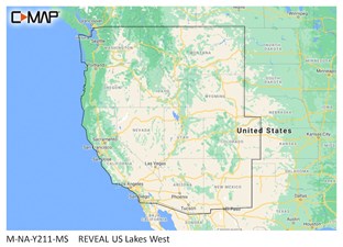
C-MAP® REVEAL™ - US Lakes West
The premium mapping solution for cruisers, anglers and sailors looking for accurate, quality data with game-changing shaded relief from the market-leader.
REVEAL™ COASTAL
The ultimate chart for coastal exploring – with all the features of DISCOVER™ and more. Shaded Relief will let you see the seafloor like never before – previously only available in select areas, now available everywhere. Identify structure, reefs and ledges to find the best fishing and diving spots.
Packed with features, including Tides & Currents, Raster Charts, Satellite Overlay and Aerial Photo’s and 12 months’ free updates.
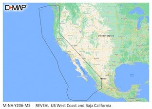
C-MAP® REVEAL™ - US West Coast and Baja California
The premium mapping solution for cruisers, anglers and sailors looking for accurate, quality data with game-changing shaded relief from the market-leader.

C-MAP® REVEAL™ - Central America and The Caribbean
The premium mapping solution for cruisers, anglers and sailors looking for accurate, quality data with game-changing shaded relief from the market-leader.
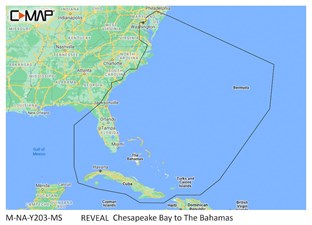
C-MAP® REVEAL™ - Chesapeake Bay to The Bahamas
The premium mapping solution for cruisers, anglers and sailors looking for accurate, quality data with game-changing shaded relief from the market-leader.
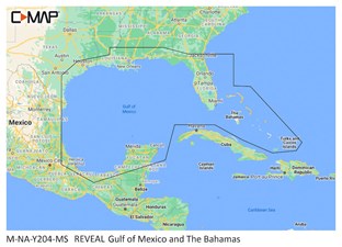
C-MAP® REVEAL™ - Gulf of Mexico and The Bahamas
The premium mapping solution for cruisers, anglers and sailors looking for accurate, quality data with game-changing shaded relief from the market-leader.
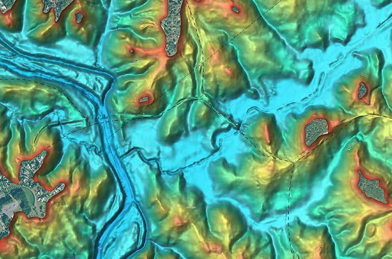
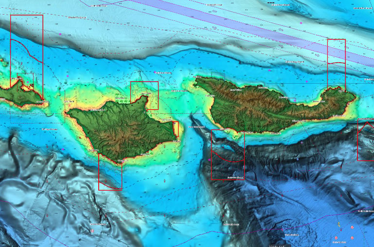
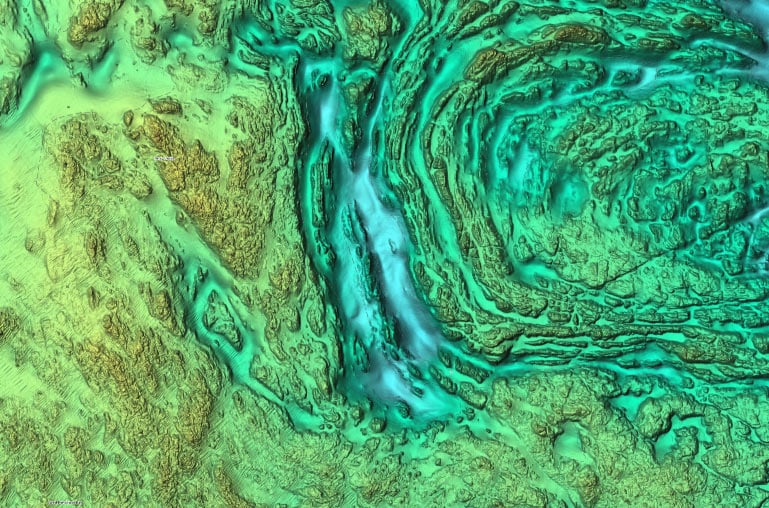
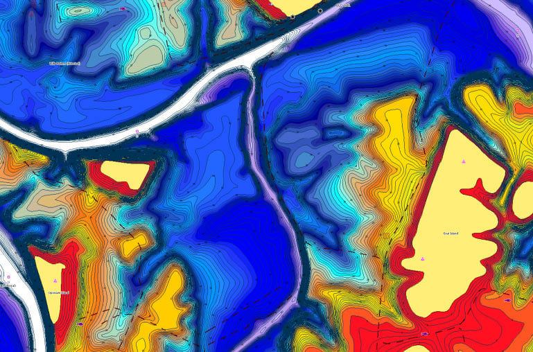
SHADED RELIEF
Bring the world around you to life, with 3D rendered land and underwater elevation – including areas of Ultra-High Res Bathymetric imagery previously only available in MAX-N+ Reveal – a game-changer for anglers and divers.
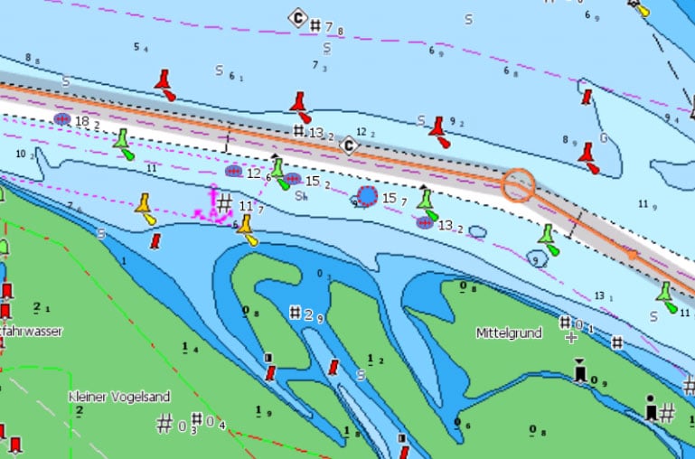
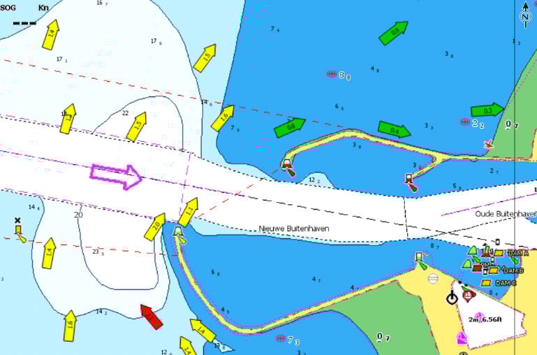
FULL-FEATURED VECTOR CHARTS
Full Featured Vector charts make navigation easy by giving you accurate, up-to-date vector chart detail derived from official Hydrographic Office information.
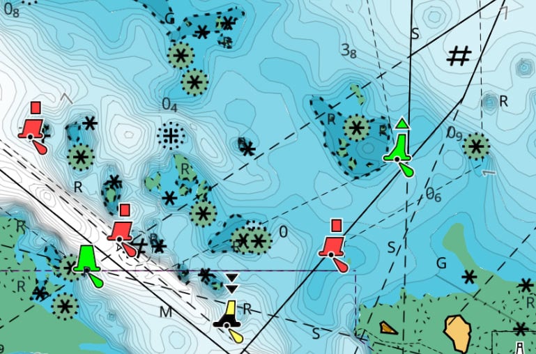
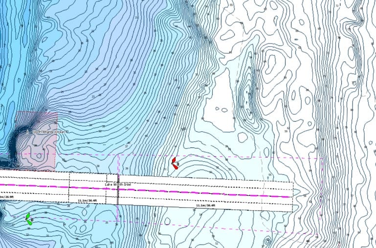
HI-RES BATHYMETRY LAYER
High-Res Bathy helps you identify shallow areas, drop offs, ledges, holes or humps by accurate contour lines down to 1-foot level of detail. Includes the very best of C-MAP® HRB data, including C-MAP® Team Lake Surveys (US only) and Genesis® social maps, quality controlled and fully integrated.
CUSTOM DEPTH SHADING
Custom Depth Shading allows you to set a safety depth, maintain a paper-like view or set your own custom shading – see things your way.
SATELLITE OVERLAY
Satellite imagery gives information about the surroundings when you find yourself in an unfamiliar place.
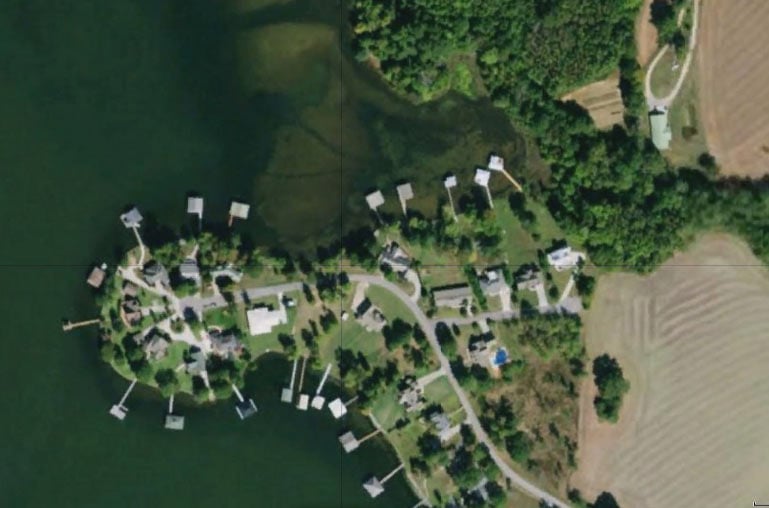

AERIAL PHOTOS
A collection of thousands of photos of marinas, harbors, inlets and other notable navigational features included to offer an additional level of detail.
DYNAMIC RASTER CHARTS
Providing the traditional chart look and feel, coupled with easy access to all objects on the chart.
EASY ROUTING
Easy Routing helps you automatically plot the shortest, safest route based on detailed chart data and your personalized vessel information. C-MAP® Easy Routing is always subscription free.
TIDES & CURRENTS
Tides & Currents show projections of water level and direction of tides to help plan your day out, whether cruising, angling or sailing. Only available with coastal charts
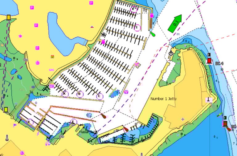
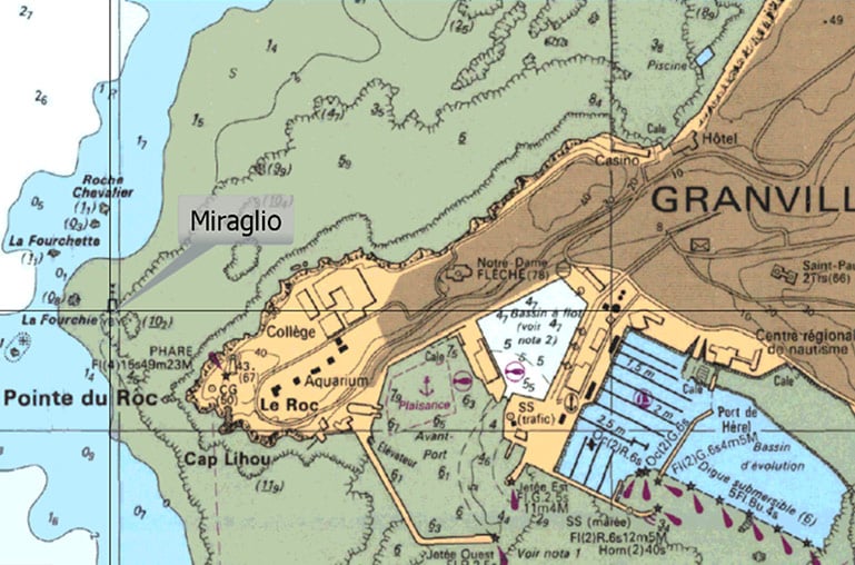
DETAILED MARINA PORT PLANS
Docking in an unfamiliar port is no problem, when you have precise layouts of thousands of marinas, including slip spaces, restricted areas, and other valuable navigation information.


