Wherever you’re fishing on your local lake or on the coast, ensure you stay safe with the latest chart data. Lowrance fishfinders are compatible with leading providers, including C‑MAP®.
MAPPING
MAPPING
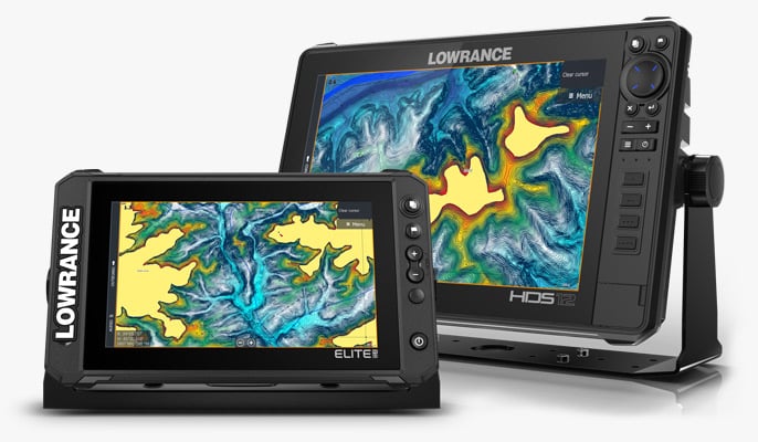
MAKE THE MOST OF YOUR TIME ON THE WATER WITH THE BEST CHARTS
MAPPING
MAPPING
MAKE THE MOST OF YOUR TIME ON THE WATER WITH THE BEST CHARTS
C-MAP® DISCOVER ONBOARD™
Exceptional mapping built right into the display
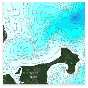
C-MAP® DISCOVER OnBoard™ inland and coastal charts are embedded in all HDS PRO and Elite FS displays and bundled as an SD card with select Eagle models. You will have more success on the water with full-featured Vector Charts, integrated Genesis® Social Map data, Custom Depth Shading, unique fishing POIs, and high-resolution, bathymetric 1-foot contours on 19,000+ U.S. lakes and 9,400+ lakes in Canada.
View the list of lakes included in DISCOVER OnBoard™+
24,000+ LAKE COVERAGE
VECTOR CHARTS
HI-RES BATHYMETRY
CUSTOM DEPTH SHADING
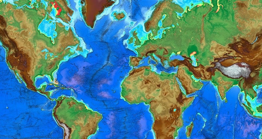
C-MAP® REVEAL™
REVEAL™ charts bring you the very best of C-MAP®, including all features found in DISCOVER™ and more - includes game-changing Shaded Relief, bringing the world around and beneath you to life in a completely new way.
SHADED RELIEF
CUSTOM DEPTH SHADING
SATELLITE OVERLAY
RASTER CHARTS
C-MAP® DISCOVER™
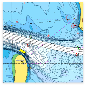
DISCOVER™ all you need to make the most of your time on the water. Full-featured Vector Charts with High-Res Bathymetry, including integrated Genesis® social data, subscription-free Easy Routing™ and Custom Depth Shading. Includes 12 months of free online updates.
EASY ROUTING™
VECTOR CHARTS
HI-RES BATHYMETRY
TIDES & CURRENTS
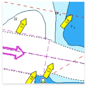
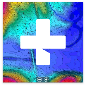
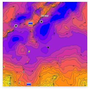
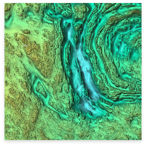
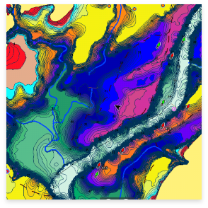
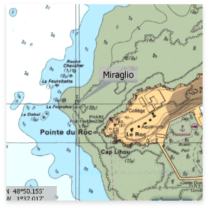
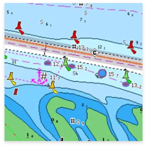
CHART EXPLORER
Explore chart detail with C-MAP® Chart Explorer.

CHART EXPLORER
Explore chart detail with C-MAP® Chart Explorer.
CHART COMPARISON
| DISCOVER OnBoard™ | DISCOVER™ | REVEAL™ | |
| FULL FEATURED VECTOR CHARTS | |||
| HIGH-RESOLUTION BATHYMETRY | |||
| GENESIS DATA | |||
| CUSTOM DEPTH SHADING | |||
| TIDES & CURRENTS | |||
| DETAILED MARINA PORT PLANS | |||
| MULTI-LANGUAGE | |||
| MARINE PROTECTED AREAS* | |||
| C-MAP SURVEY LAKE DATA | |||
| SUBSCRIPTION-FREE EASY ROUTING™ | |||
| 12 MONTHS’ FREE ONLINE UPDATES | |||
| RASTER CHARTS* | |||
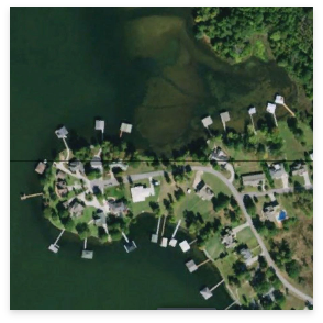
| AERIAL PHOTOS* | |||
| SATELLITE IMAGERY* | |||
| SHADED RELIEF REVEAL |
*Available in select areas
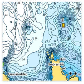
C-MAP® GENESIS® SOCIAL MAPPING

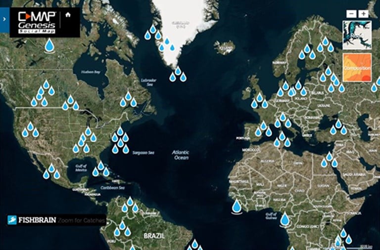
C-MAP Genesis charts have revolutionized freshwater fishing, and also offer huge advantages to saltwater anglers. Through user-generated data, precise 1-foot contour detail is available for once uncharted water systems. With features such as custom depth shading, vegetation and bottom composition layers as well as live mapping, C-MAP Genesis will help you find more fish and navigate new water safely.
LOWRANCE APP
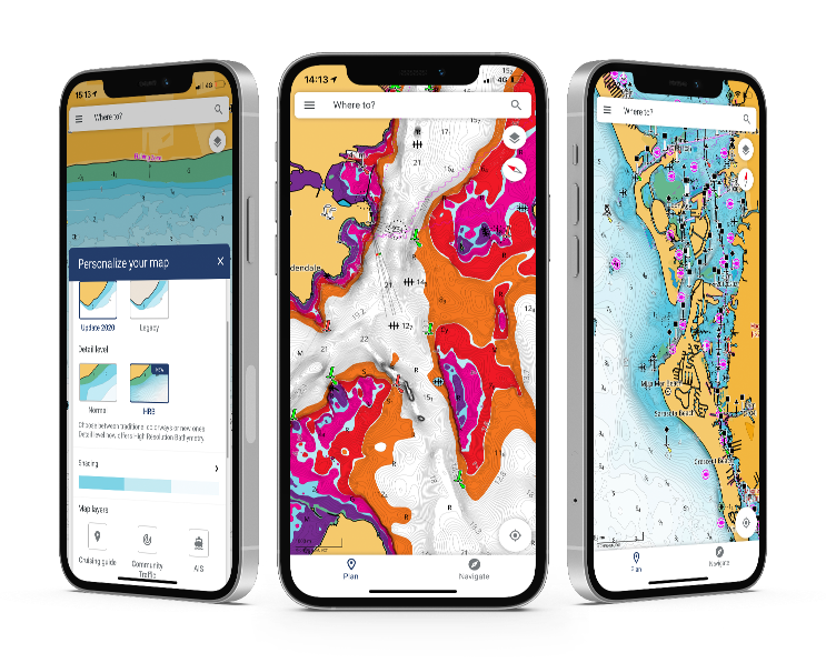
With all the latest and most detailed charts from C-MAP®, the Lowrance App gives you the most accurate charting and layers on a mobile device, allowing you to easily manage your favourite waypoints, discover new fishing spots and plan your next trip in advance. Simply step on board sync your data with your Lowrance device and spend more time fishing, saving any top spots for future trips.
LOWRANCE MAPPING COMPATIBILITY

FEATURED CHARTS
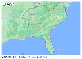
C-MAP® REVEAL™ - US Lakes South East
The premium mapping solution for cruisers, anglers and sailors looking for accurate, quality data with game-changing shaded relief from the market-leader.
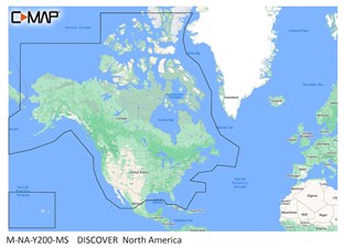
C-MAP® DISCOVER™ - North America
The perfect mapping solution for cruisers, anglers and sailors looking for accurate, quality data and ultra-wide coverage from the market-leader.
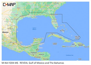
C-MAP® REVEAL™ - Gulf of Mexico and The Bahamas
The premium mapping solution for cruisers, anglers and sailors looking for accurate, quality data with game-changing shaded relief from the market-leader.
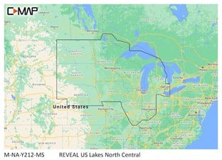
C-MAP® REVEAL™ - US Lakes North Central
The premium mapping solution for cruisers, anglers and sailors looking for accurate, quality data with game-changing shaded relief from the market-leader.


