LOWRANCE APP
THE PERFECT FISHING COMPANION
THE PERFECT FISHING COMPANION
![]()
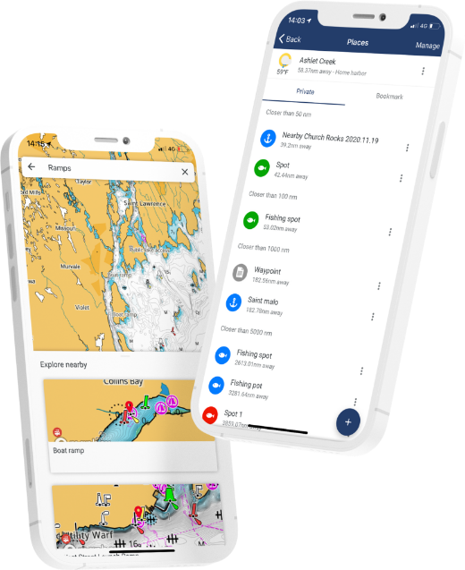
MANAGE YOUR WAYPOINTS
![]()
DISCOVER NEW FISHING SPOTS
![]()
REVIEW YOUR DATA
![]()
SYNC EASILY WITH YOUR DEVICE
Download for free now:
![]()
![]()
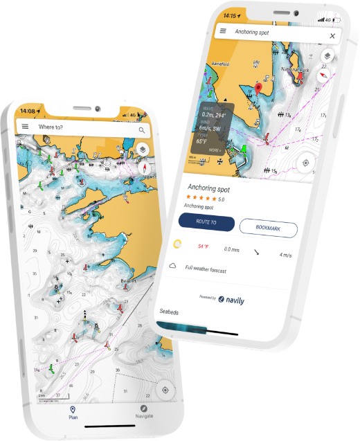
With all the latest and most detailed charts from C-MAP®, the Lowrance App gives you the most accurate charting and layers on a mobile device, allowing you to easily manage your favourite waypoints, discover new fishing spots and plan your next trip in advance. Simply step on board sync your data with your Lowrance device and spend more time fishing, saving any top spots for future trips.
| DETAILED CHARTS | HRB WITH AUTOROUTING | SOCIAL LAYERS | CUSTOM DEPTH SHADING | SHADED RELIEF |
 |
 |
 |
 |
 |
DETAILED CHARTS
HRB WITH AUTOROUTING
SOCIAL LAYERS
CUSTOM DEPTH SHADING
SHADED RELIEF
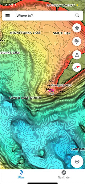
The Lowrance App allows you to create, store, edit and share your waypoints and fishing spots anytime, anywhere. All the tools you need to plan your fishing trips in advance. With offline charts, you can also download your charts to the app and view data even when you are in an area without mobile coverage or WiFi out on the water.
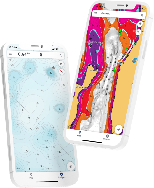
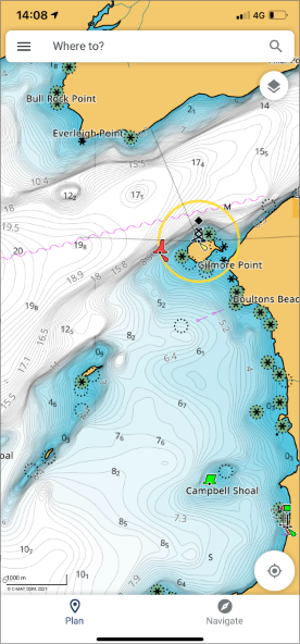
With the Lowrance App, you have all the tools you need to discover new fishing trips and spots in advance. This includes access to the latest C-MAP® cartography with high-resolution bathymetry charts, custom shading and thousands of Points of Interest, including ramps and fuel near you. You can even use Autorouting™ to set the best routes automatically to your waypoints.
The Lowrance App gives you the freedom and flexibility to save your waypoints, fishing spots and data with your Lowrance devices when you step on board, giving you more time to concentrate on the important stuff, catching more fish!
Simply sync back your app and Lowrance device anytime on or off the water, so you can have all your latest fishing trip data with you at all times.
![]()
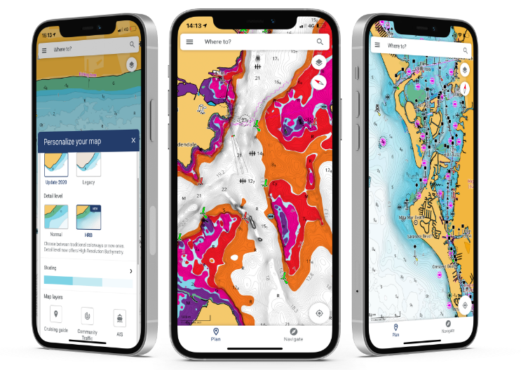
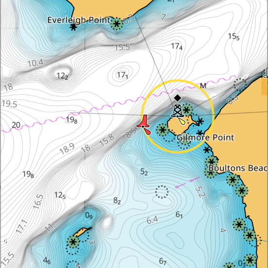
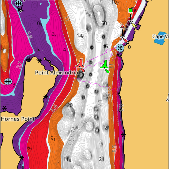
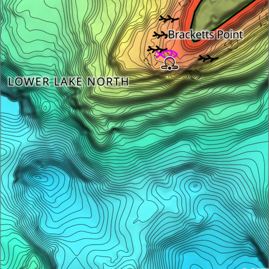
With high-resolution bathymetry, the maps are carefully crafted to highlight the most important information at any given time and are continuously updated.
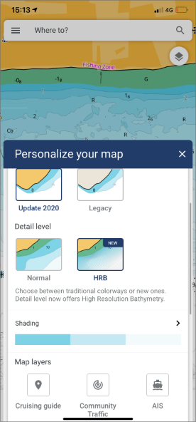
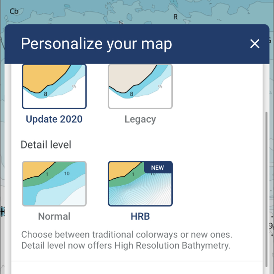
Personalize the map to your preferences including chart colourways and detail levels, map rotation, your boat data such as height and depth limits and much more.
![]()
Access to exceptional weather data to help you plan but also stay safe on the water including data on sea-state and waves, tides, temperature, precipitation, the moon phase and much more.
![]()
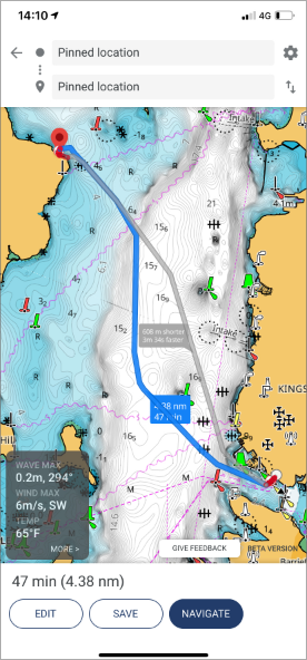
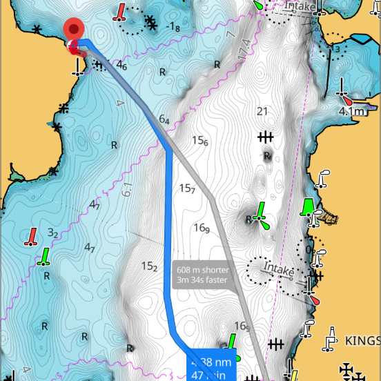
The best routing in an app, it lets you plot a route and check your ETA quickly, as well as weather along the route.
Explore thousands of Points of Interest such as ramps, fuel, marinas, harbours, beaches, shops and much more.
![]()
Mirror and remotely control any connected Lowrance fishfinder through the app, offering the ultimate freedom and control on board.
![]()
Share your position with friends and family. This feature allows you to be seen and see other app users around you out on the water.
![]()
See boats with class A and B enabled AIS within a 100km radius, as well as their position, speed and course, without sharing your position.
![]()
Register and connect your Lowrance devices to the app and access a library of manuals, guides and how to videos.
| FREE | |
| Up-to-date nautical charts | |
| Personal waypoints, routes and tracks | |
| Manual and Autorouting | |
| Measure distance tool | |
| Thousands of Points of Interest | |
| Marine weather forecast | |
| Weather along the route for 24 hours | |
| Weather overlay for 24 hours | |
| GPX import and export | |
| Chart personalization: boat size, favourite units of measurement, favourite map type or view mode (Auto, light or dark) and more | |
| Device registration | |
| Device support: manuals, guides, videos | |
| Mirroring and Control | |
| Offline sync of Waypoints, Routes and Tracks | |
| NEW: Sharing Tracks | |
| NEW: Personalised Push Notifications | |
|
PREMIUM Everything in FREE plus: |
|
| Offline maps (Global chart) | |
| AIS | |
| 5-day weather along the route | |
| Navigation: GPS data, navigation line, track record | |
| Traffic: keep an eye on other app users around | |
| 5-day weather overlay | |
| High-resolution Bathymetry | |
| Custom Depth Shading | |
| Shaded Relief | |
| NEW: Anchoring Alert | |
| NEW: Satellite Overlay | |
Personalise waypoints and fishing spots
How to do chart personalisation
How to sync
Ratings and Reviews


Download for free now:
![]()
![]()


