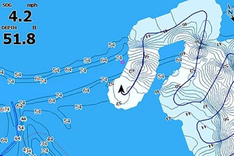
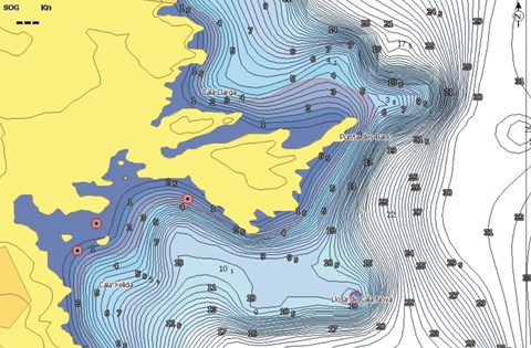
Massa, Italy – C-MAP, a leader in digital marine cartography and cloud-based mapping, today announced the release of a new version of their MAX N+ charts featuring a variety of updates and improvements. Enhancements to the charts include new port plans, as well as additional detail to existing ports, High Resolution Bathymetry (HRB), Genesis Layer overlay and more detailed information at all zoom levels.
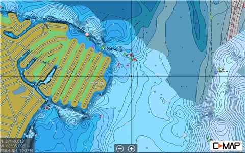
The new improvements to C-MAP MAX-N+ charts also allow all information to be displayed and viewable, whatever the zoom level. Available now, the improvements come with new chart purchases or as a download from gofreemarine.com.
For more information on the new CMAP Improvements, please visit c-map.com.


