| FREE | |
| Up-to-date nautical charts | |
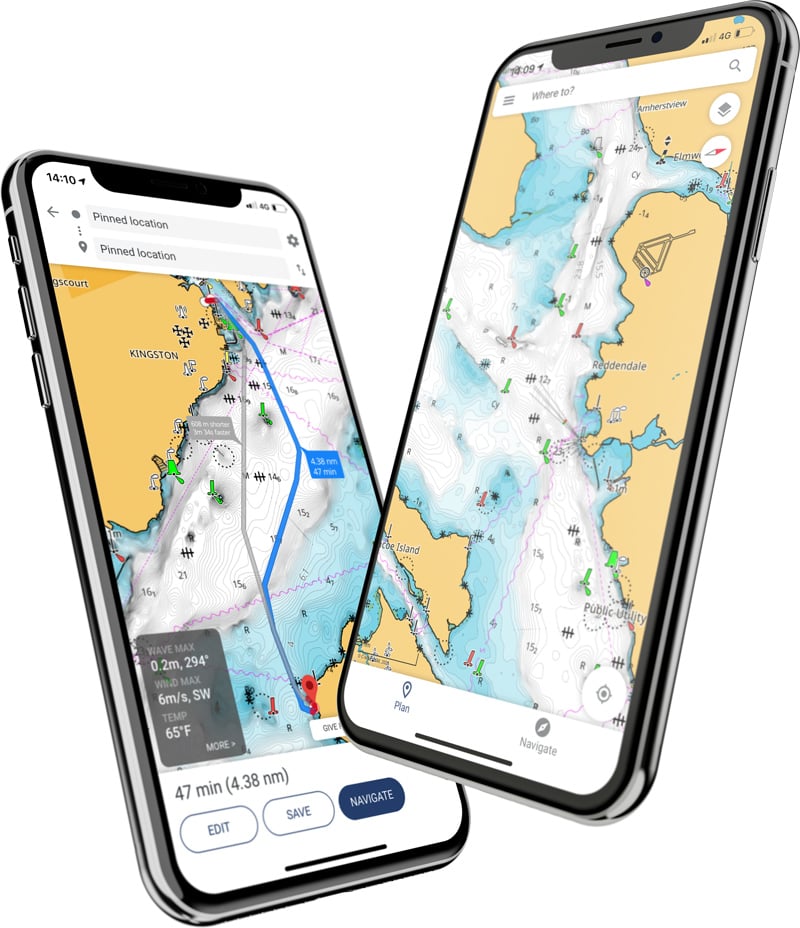
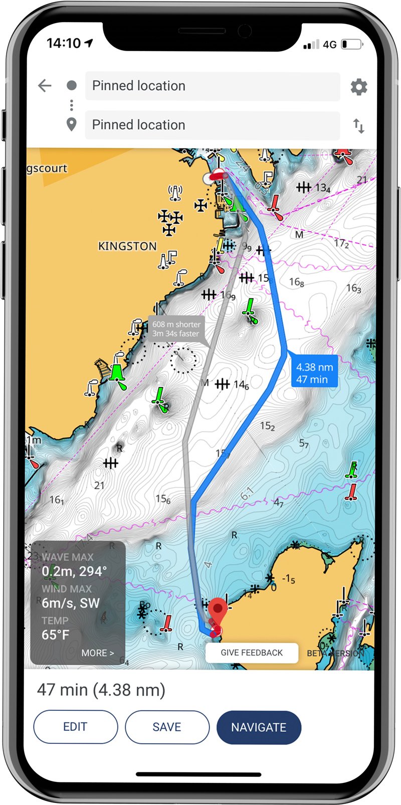
| Personal waypoints, routes and tracks | |
| Manual and Autorouting | |
| Measure distance tool | |
| Thousands of Points of Interest | |
| Marine weather forecast | |
| Weather along the route for 24 hours | |
| Weather overlay for 24 hours | |
| GPX import and export | |
| Chart personalization: boat size, favourite units of measurement, favourite map type or view mode (Auto, light or dark) and more | |
| Device registration | |
| Device support: manuals, guides, videos | |
| Mirroring and Control | |
| Offline sync of Waypoints, Routes and Tracks | |
Tulsa, Okla. – Lowrance®, a world-leader in fishing electronics since 1957, officially unveiled its Lowrance® App this week including a set of new premium features, advanced functionality and seamless synchronization with the full range of Lowrance fishfinders and chartplotters.
The Lowrance App is free to download and offers a rich experience that includes free up-to-date and detailed nautical charts from C-MAP®, creation and management of all your personal waypoints, routes and tracks, along with the latest marine weather, important points of interest and much more.
The app allows you to register your Lowrance device(s) ensuring you have the latest software, manuals, information and tips related to your devices, as well as the ability to synchronize data, mirror and control right from your mobile device. It’s available on both the Apple Store for iOS and Google Play for Android.
“The ability to easily manage, create and plan your waypoints, routes and tracks in your app and then seamlessly synchronize with your Lowrance display from anywhere on the boat right from the palm of your hand will enable anglers to spend more time doing what we love: fishing,” said Lucas Steward, EVP of Lowrance. “Whether you are using the free or the new premium version, we are confident all anglers will be blown away with the high-resolution, detailed C-MAP charts.”
The premium version of the Lowrance App includes custom depth shading – a key feature for anglers – as well High-Resolution Bathymetry Charts, offline maps and global charts, Automatic Identification System (AIS), Lowrance App Traffic, 5-day weather along the route and 5-day weather overlay, GPS navigation data and line and track record.
“While there is a lot on offer in the premium version, the simplified ‘freemium’ option still provides a long list of very useful and valuable technology and functionality for anglers, right to your smart phone or tablet at no cost,” added Steward.
The detailed C-MAP charts on the app are carefully designed to highlight what is most important at any given time during your fishing experience, maintaining accuracy and a clean, uncluttered view at key fishing locations for the ultimate fishing experience.
|
PREMIUM Everything in FREE plus: |
|
| Offline maps (Global chart) | |
| AIS | |
| 5-day weather along the route | |
| Navigation: GPS data, navigation line, track record | |
| Traffic: keep an eye on other app users around | |
| NEW: 5-day weather overlay | |
| NEW: High-resolution Bathymetry | |
| NEW: Custom Depth Shading | |


